Lake Anna waterfront rules · Part 6 of 8
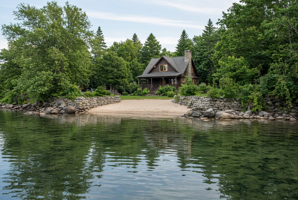
Rock to hold a bank, or sand where the mud is. Both are doable here. The approvals run in a fixed order, and the first one decides whether the rest are worth applying for.
Two projects come up constantly at Lake Anna. Stabilizing a bank, and putting in a beach.
Neither one starts with a contractor. They start with finding out whose land you are standing on, because almost all of this work happens on ground your deed does not cover.
Start with the short answer
You can stabilize a bank. Riprap and bulkheads are both allowed, and vegetated methods are encouraged ahead of either.
You can have a beach. Louisa's ordinance says so in one sentence: sand beaches shall be permitted if they are properly retained. The whole project lives in that last word.
What you cannot do is start. Dominion approves before your county does, and on beaches specifically there is a wrinkle worth knowing up front: Dominion has published no beach standard at all.
Whose bank is it?
Your deed does not run to the water. Dominion holds the shore land between the water and where your property stops, and what you hold across that strip is a set of reserved Recreational and Agricultural rights, not ownership. Part 1 covers this in full.
One caution, because it circulates constantly. People will tell you the line sits at the 250-foot contour. Dominion publishes 250.00 feet above mean sea level as normal lake level, and that is the datum heights and setbacks get measured from. They do not publish it as the boundary. Where your line falls is a parcel by parcel question answered by your deed and plat, and a flat lot has considerably more Dominion shore land between the yard and the water than a steep one.
So before you price anything, pull your plat. Get a surveyor if it is not clear.
Dominion signs off first
Work on Dominion shore land runs through the Construction and Use Agreement, the same instrument behind docks in Part 2 and utilities in Part 4. It is Dominion's written consent to a specific project in a specific place, and the signed copy that comes back is your approval.
The submission is low-tech. Two dimensioned sketches on 8.5 by 11 paper, two copies of those and your plats, the agreement signed, and a notarized rights certification with a copy of your deed. Mail it to the Reservoir Coordinator at North Anna, who comes out and looks at the site before issuing consent. Build that visit into your timeline. There is no fee stated in the document, the agreement is revocable, and how it carries to the next owner is its own subject, covered for docks in Part 3.
On stabilization the agreement is unusually clear, and it answers what people normally guess at. Riprap or a bulkhead stays inside your own frontage lines projected to the water, aligned with normal lake level, and it has to be there for the sole purpose of bank stabilization. That phrase matters: a structure whose real job is extending usable yard out over the lakebed is not what the agreement authorizes. Bulkhead fill must be clean material, with fabric cloth and gravel behind the wall, and the wall driven in tightly enough to stop seepage. Dominion recommends rock placed out front and suggests plantings. Debris and tires are named as unacceptable, which is in there because people have tried it.
Note what is absent. The words "seawall" and "retaining wall" never appear. Dominion addresses riprap and bulkhead. A wall at the water is a bulkhead regardless of what the estimate calls it.
On beaches, Dominion has published nothing
We went looking for a written beach rule. It is not in the Construction and Use Agreement, which covers bulkhead backfill and says nothing about sand, fill or grading. Not in the Lake Anna fact sheet. Not on the Lakes and Recreation pages or in the North Anna document list.
Silence is not permission and it is not prohibition. Here is what it actually means. Hauling sand onto Dominion shore land is work on Dominion land, which requires approval. Louisa, for its part, states that Dominion's standards govern filling, and hauling sand is filling. So the county hands the question to Dominion, and Dominion has not written the answer down.
That leaves one path: call the Reservoir Coordinator about your specific shoreline before you price the job. Anyone who tells you confidently what Dominion's beach rule is at Lake Anna is repeating something they heard.
A beach is a retention problem, not a sand problem
On the county side, nobody is really regulating sand. They are regulating where it goes next.
Louisa treats a beach as a landscaping measure requiring a retaining structure along the upper side, to keep runoff from carrying sand into the lake. The site plan has to show the beach retained on all sides, with construction details for the retaining structure itself.
That reframes the budget. The engineered, permitted part of a Lake Anna beach is the thing holding the sand in place. The sand is cheap, and a load of it with nothing around it is the version that gets turned down, because in a few seasons it is not your beach anymore, it is sediment in the cove. It is also why the good beaches here tend to sit next to riprap. The toe protection keeping your bank in place is often the same structure keeping the sand where you put it, which makes designing them together cheaper than building the beach now and fixing erosion later.
Then your county, and the three are not the same
Anyone handing you one set of shoreline rules for the whole lake is handing you one county's rules.
Louisa County: the only Lake Anna shoreline ordinance
Louisa is the only one of the three with an ordinance written for this lake, and the path for a project under 10,000 square feet of disturbance runs in three steps. Dominion's agreement first. Then the Zoning Administrator, who reviews the site plan and forms. Then the Building Official, who issues the permit, with a final inspection at the end.
On method, the ordinance sets a preference most people have backward. Vegetated stabilization is strongly encouraged. If you go structural, the permitted materials are riprap and bulkhead, both with geotextile fabric beneath, and anything else needs soil and water conservation district approval. Riprap is not favored over a bulkhead. They are the two structural options, equally, and "seawall" does not appear in the ordinance at all.
Then a detail that surprises contractors. The district support letter is required for vegetated methods and not for riprap or a bulkhead. The rock-and-wall version needs less outside review than the gentler one. Worth knowing if you are choosing between approaches, because the softer option can also cost a fraction of a wall.
One line is worth reading twice if your bank is already going: shoreline erosion not caused by land disturbance is not required to be stabilized, though it is encouraged. Nobody will make you fix it. That is your call and your asset.
Community Development is at 540-967-3430. Ask which version of the standards is current, because the county's web page and its own posted ordinance give different amendment dates. Violations run $1,000 per day.
Spotsylvania County: the Chesapeake Bay Act applies here
This is the biggest difference between the two sides of the lake, and it changes the project rather than adding a form to it.
Spotsylvania is in Tidewater Virginia under state law, so the Chesapeake Bay Preservation Act applies and the county runs it as a countywide overlay. A perennial water body plus the land within 100 feet creates a Resource Protection Area, and that 100-foot buffer stays undisturbed and vegetated. The state regulation is blunt about it: the buffer is not reduced in width by permitted uses, encroachments or clearing. The Lake Anna connection is drainage, since the lake runs to the North Anna, the Pamunkey, the York and ultimately the Bay.
The better news is that this work is contemplated inside the buffer rather than banned from it. Shoreline erosion control is allowed with county approval, with the buffer reestablished in native woody vegetation afterward. Docks and seawalls are treated as water-dependent structures approvable with a site plan and a Water Quality Impact Assessment. And "beach" appears inside the county's own definition of a water-dependent facility, which is a better starting point than most owners expect.
What is not allowed: clear-cutting, converting buffer vegetation to lawn, and accessory structures in the buffer without an approved exception. The land disturbance threshold is also much lower than Louisa's, at more than 2,500 square feet, and Bay program penalties run to $5,000 per day.
Call Environmental Codes at 540-507-7219 and ask for a determination of whether your frontage is mapped as Resource Protection Area. That one answer shapes the whole project. And do not let anyone apply Spotsylvania's 150-foot Reservoir Protection buffer to your lot. That overlay covers Hunting Run, Ni River and Motts Run, not Lake Anna.
Orange County: fewer written rules, same questions
Orange has the smallest share of frontage and the least written on this subject. It is not in Tidewater Virginia, so there is no Bay Act buffer, and we found no county ordinance or form addressing shoreline stabilization, beaches or retaining walls on lake frontage.
What does exist is the land disturbance path, with a threshold reported as low as 2,500 square feet on residentially zoned property. Confirm that figure with the county, since it comes from a single application form. Because Orange has neither a lake ordinance nor a Bay Act buffer, Dominion's approval carries more weight there than anywhere else on the lake.
Your HOA may still say no
Same warning as Part 5, and it applies just as hard here. A project that clears Dominion and clears your county can still be stopped by recorded covenants or an architectural committee.
Shoreline structures are a common subject in Lake Anna covenants, and communities with shared waterfront often have the most specific language of anyone. Read the shoreline and architectural sections during your study period, not the dues and the paint colors. The private rulebook is frequently the strictest one on the stack.
What about the Army Corps and DEQ?
Fair question, and the practical answer here is that they almost never come up. Louisa's shoreline stabilization packet is the most detailed document any of the three counties publishes on this work, and it does not mention the Corps, DEQ or the Marine Resources Commission anywhere. The path at Lake Anna is Dominion, then county.
There is a reason it stays quiet. No public Corps document establishes whether Lake Anna is federally jurisdictional water. This is a man-made impoundment on land Dominion bought and flooded, and nothing published settles it either direction.
Where it could matter is volume of fill below the water line, since there is no blanket federal permit for hauling in sand. On an unusually large project, ask before the trucks arrive. On a normal residential job, your county and a contractor who works this lake will tell you if you are near that line, and you usually are not.
The agreement recorded against your deed
This is the piece with the longest tail, and almost nobody mentions it at the time.
In Louisa, a permanent shoreline measure comes with a notarized maintenance agreement that gets recorded with your deed at the Circuit Court Clerk's office. It says the owner is solely responsible for maintaining the measure, and shall repair or replace it in cases of natural erosion, flooding, or permanent changes in the normal lake level.
Read that with a buyer's eyes. Dominion's documents describe a lake normally around 250 feet with roughly two feet of fluctuation, a stated maximum high of 255 and low of 242. As of October 26, 2026, the posted level was 248. A recorded, perpetual obligation to repair a structure after flooding or a lasting change in lake level is a real commitment attached to the land, and it runs to whoever owns the property next.
Which cuts both ways at a closing. If you are selling with existing riprap or a beach, find the Construction and Use Agreement, the approved site plan, the permit and the final inspection, and put them in one folder before you list. A buyer who can see the work was approved and inspected treats it as an improvement. A buyer who hears "the previous owner handled that" discounts for the uncertainty, and the discount is reliably larger than the cost of finding the paperwork.
Buying? Four shoreline questions
- Where is the property line, and how much of this is Dominion shore land? Get the plat. On a flat lot, more of what you are looking at belongs to Dominion than you think.
- Is there a signed Construction and Use Agreement for this structure, and may I see it? You are confirming the work has approved standing behind it, and getting the sketches and the date on file while the seller can still find them.
- Was a maintenance agreement recorded against this deed? Title work will show it. That is a perpetual repair obligation you would be assuming.
- What is the condition at the toe, not the top? Walk it at low water, which is most of the cold season. A wall that looks fine from the yard can be undermined at the base, and that is the expensive failure.
Thin answers are not a reason to walk. They are a reason to price the work and the paperwork into your offer, with real numbers from a contractor who works this lake.
Where to start
- Your plat and deed, and a surveyor if the line is unclear.
- Dominion's Reservoir Coordinator, 540-894-2307 or [email protected]. If it is a beach, say so and ask what they will consider, because there is nothing written for you to read first.
- Your county. Louisa Community Development 540-967-3430. Spotsylvania Environmental Codes 540-507-7219. Orange's building and development office.
- Your soil and water conservation district, which also runs cost share programs for homeowners. Louisa is served by Thomas Jefferson at 540-967-5940, Spotsylvania by Tri-County/City at 540-656-2401, Orange by Culpeper at 540-825-8591.
- A contractor who has done this on Lake Anna specifically. They file these approvals routinely and they will tell you what the current queue looks like, which no document will.
If the answer for your shoreline turns out to be that the beach is not happening, that is useful information rather than a failure. Plenty of good Lake Anna properties have a bank instead of a beach, and a well-built stabilized bank holds value better than sand that washes into the cove every spring.
Please verify before you act on it. This reflects the best research we could do as of October 2026, from Dominion's published Construction and Use Agreement, Louisa County's shoreline ordinance and permit packets, and Spotsylvania and Orange county materials. Some of it is genuinely unsettled in anything published, including whether federal jurisdiction reaches Lake Anna and whether Dominion will approve a given beach, and we have said so rather than filling the gaps. County documents also disagree in places on which version of a standard is current. Confirm with Dominion's Reservoir Coordinator and your county before you commit money, and check your HOA covenants, which may be stricter than any of it.
What we are and are not. The M Group is a real estate brokerage. We are not a law firm, an engineering firm, a marine contractor or a permitting authority. Nothing here is a legal opinion or an engineering judgment, no agency or company named has reviewed or endorsed it, and we disclaim warranties and liability for decisions made from it. It is a starting point for better questions.
The Lake Anna Waterfront Rules series
Part 1: The Dominion Easement at Lake Anna: What It Really Is
Part 2: How Big a Dock Can You Build at Lake Anna, Virginia? (2026)
Part 3: Does a Lake Anna Dock Convey With the House?
Part 4: Can You Run Power and Water to a Lake Anna Dock? (2026)
Part 5: Can You Cut Trees on the Lake Anna Shoreline? (2026)
Part 6: Can You Build a Sand Beach at Lake Anna? (this article)
Part 7: Dredging and hydrilla, coming next
Part 8: Who to call, and in what order
Next in Part 7: the shallow slip, the weed problem, and the narrow October to March window when dredging is allowed at all.
Buying or selling waterfront at Lake Anna?
Send us the address and we will tell you what we can see about the shoreline before you plan anything on it: where the Dominion line likely falls, what your county requires, and whether an existing wall or beach has paperwork behind it.
Talk to us about buying at Lake Anna, or get a straight answer on what your waterfront is worth.
If the project you are picturing will not work on that parcel, we will tell you that too.
Michael Boyce II, Real Estate Professional
The M Group, Real Broker, LLC
540-870-0437
[email protected]
www.themgroupva.com
Melanie Lucero, Real Estate Professional
The M Group, Real Broker, LLC
540-870-0714
[email protected]
www.themgroupva.com
Want the lake in your inbox? The Lake Life Briefing goes out weekly with lake levels, what is happening around the water, and new listings. Sign up here.
